Earliest World Map Featuring Portuguese Exploration
Italy
Geography
Exploration
3 min read
Updated By: History Editorial Network (HEN)
Published:
Updated:
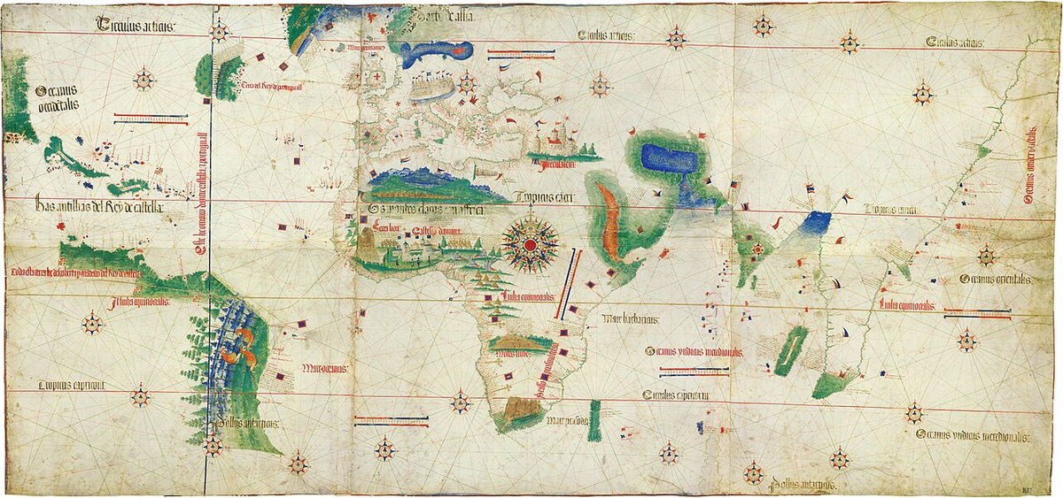
The Cantino Planisphere is recognized as the earliest world map that specifically illustrates Portuguese maritime exploration. This map was created in the early 16th century and serves as a crucial historical document that reflects the geographical knowledge and navigational routes of the time. The map highlights the territories discovered by Portuguese explorers, showcasing their significant role in the Age of Discovery. The Cantino Planisphere not only depicts the coasts of Africa and the Americas but also includes various islands and regions that were pivotal to Portuguese trade and exploration efforts. This map is a testament to the advancements in cartography during this period, as it incorporates new information gathered from explorers who ventured into uncharted waters. The Cantino Planisphere is significant for its detailed representation of the world as understood by Europeans at the time, marking a shift in how geography was perceived and recorded. It reflects the growing interest in global exploration and the competition among European powers to expand their empires and influence across the globe. The map is an essential artifact for understanding the historical context of maritime exploration and the impact of Portuguese navigators on world history.
#mooflife
#MomentOfLife
#CantinoPlanisphere
#PortugueseExploration
#WorldMap
#MaritimeHistory
#AgeOfDiscovery

Explore the Life Moments of