Nova Totius Terrarum Orbis Tabula Map Created
Italy
Cartography
Historical Maps
Peace Treaties
3 min read
Updated By: History Editorial Network (HEN)
Published:
Updated:
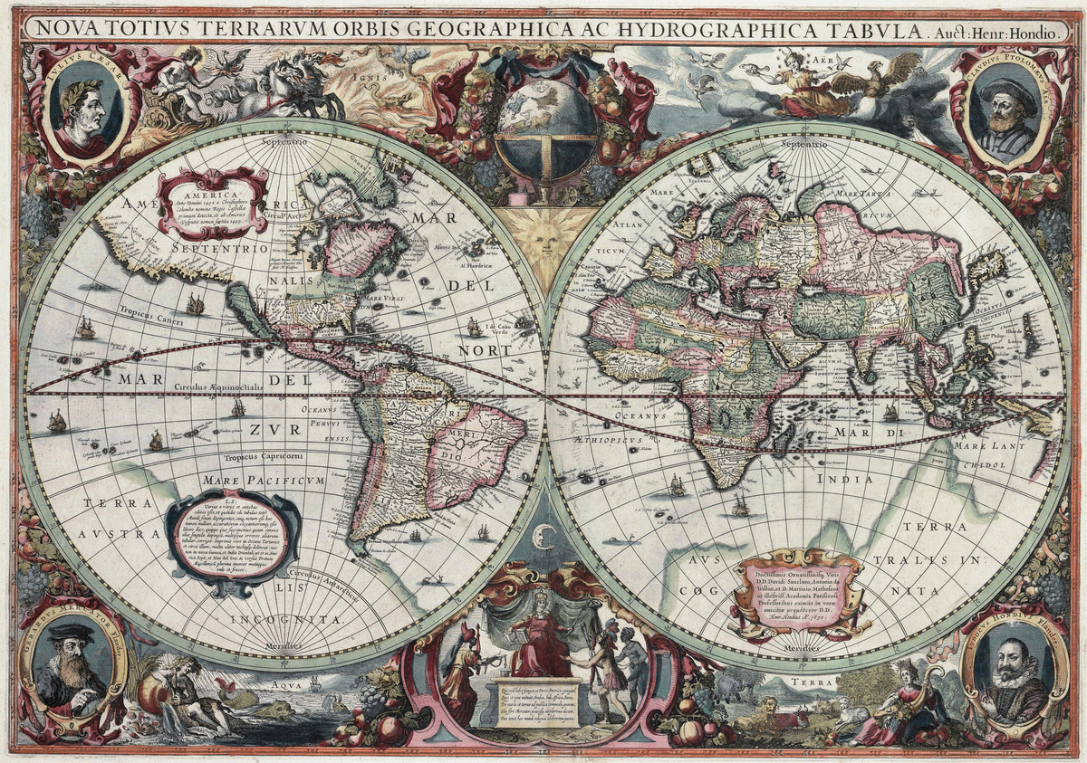
The Nova Totius Terrarum Orbis Tabula is a large world map created by Dutch cartographer Joan Blaeu during the Renaissance, a period characterized by significant advancements in art, science, and exploration. This era, spanning from 1450 to 1650, saw European explorers mapping nearly every continent, with the notable exception of Antarctica. The creation of this map was particularly significant as it commemorated the Peace of Westphalia, which ended the Thirty Years' War in Europe. The Peace of Westphalia was a series of treaties that not only marked the conclusion of a devastating conflict but also laid the groundwork for modern state sovereignty and international law. The map itself reflects the geographical knowledge of the time, showcasing the continents and regions as understood by European cartographers, and it served as a vital tool for navigation and education in the following centuries. Blaeu's work is recognized for its artistic quality and accuracy, contributing to the field of cartography and influencing future map-making practices.
#mooflife
#MomentOfLife
#NovaTotiusTerrarumOrbisTabula
#JoanBlaeu
#RenaissanceCartography
#PeaceOfWestphalia
#HistoricalMaps

Explore the Life Moments of