Dutch Cartographers Mapped Most of Australia
Italy
Cartography
Exploration
3 min read
Updated By: History Editorial Network (HEN)
Published:
Updated:
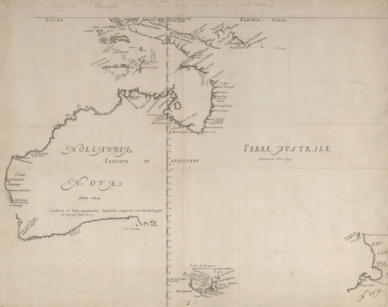
Dutch cartographers played a crucial role in the early exploration and mapping of Australia, particularly during the 17th century. Their expeditions were primarily driven by the search for new trade routes and territories. Notably, Abel Tasman was instrumental in this effort, as he circumnavigated the continent, confirming that it was not connected to the hypothetical southern continent that many believed existed. By the mid-17th century, Dutch navigators had successfully charted the majority of Australia's coastline, which they referred to as New Holland. This mapping effort laid the groundwork for future exploration and colonization by other European powers. The only significant portion of the coastline that remained unmapped by the Dutch was the eastern coast, which would later be charted by British explorer James Cook in the 18th century. The contributions of Dutch cartographers were pivotal in expanding European knowledge of the Australian continent and its geographical features, influencing subsequent exploration and settlement patterns.
#mooflife
#MomentOfLife
#DutchCartographers
#AustraliaMapping
#AbelTasman
#NewHolland
#JamesCook

Explore the Life Moments of