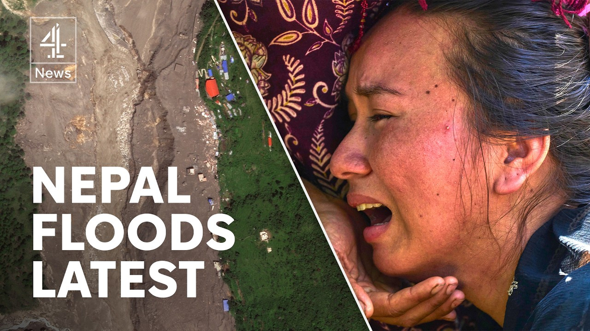
Nepal Himalayan Flash Flood: Glacier Collapse
Langtang National Park and the Bhote Koshi-Trishuli river corridor, Nepal, extending to the Nepal-Tibet border region, Nepal

Natural disaster
10 min read
Updated By: History Editorial Network (HEN)
Published:
The catastrophic Himalayan flash flood that struck northern Nepal on 26/08/2026 has killed at least 734 people in Nepal and left 2,498 others missing, according to figures released by Nepal's National Disaster Risk Reduction and Management Authority on 30/08/2026. Across the border in the Tibet Autonomous Region of China, authorities have confirmed another 16 deaths and 546 missing people, bringing the combined toll to 750 dead and 3,044 missing across Nepal and Tibet.
The disaster began at about 8:37 a.m. local time when a large mass of glacier ice and mountain debris collapsed in Langtang National Park near Lāngtāng Lirung, close to Nepal's border with China. The United States Geological Survey said seismic analysis placed the source on a glaciated mountain cliff on the northern side of Lāngtāng Lirung. The collapse generated seismic energy equivalent to a magnitude 5.2 earthquake. Initial reports had suggested that an earthquake caused the disaster, but subsequent analysis determined that no earthquake occurred and that the seismic signal was produced by the glacier collapse and debris flow itself.
Ice, rock, water and sediment rushed into the river system, producing a fast-moving debris flood that travelled through the Lhende Khola, Bhote Koshi and Trishuli river corridors. Water levels in the Trishuli reportedly rose by as much as nine metres within 30 minutes. Settlements including Timure and Syapru Besi in Rasuwa district were hit, while flooding and debris continued downstream into Nuwakot, Dhading and other districts. Across the border, the Gyirong Port area in Tibet suffered extensive destruction. Roads, bridges, homes, hydropower facilities and other infrastructure along the river valleys were damaged or destroyed.
Nepal has borne most of the confirmed human loss. By the morning of 30/08/2026, authorities had recovered 734 bodies or human remains. The scale of the flood carried victims far downstream, with bodies recovered across several districts. Chitwan recorded the largest number of recoveries, followed by Nawalparasi East, while bodies were also recovered in Nawalparasi West, Gorkha, Nuwakot, Dhading, Tanahun and Rasuwa. Indian authorities have also recovered bodies from rivers flowing out of Nepal that are believed to be connected to the disaster, although these recoveries have not been included in Nepal's official death toll.
Among Nepal's 2,498 missing people are 933 workers from hydropower projects and hundreds of foreign nationals. Rescue operations have concentrated partly on hydropower facilities along the affected river corridor, where workers were believed to have been trapped inside tunnels after mud and debris inundated project sites. Nepalese security forces, helicopters and specialist teams have continued searching damaged communities, riverbanks, tunnels and areas buried beneath thick sediment.
The disaster also affected tourists, trekkers and pilgrims travelling through the Nepal-Tibet border region. Nepal's missing-person list includes 589 foreign nationals, while Chinese authorities reported that 261 foreign nationals from 23 countries were missing on the Tibetan side. The missing in Tibet included citizens of Nepal, India, Latvia, the United States and the United Kingdom, among other countries. The region is used by international travellers heading towards destinations including Mount Kailash in Tibet.
Rescue operations have repeatedly faced difficult weather, unstable terrain, damaged transport links and the continuing threat of additional flooding. A barrier lake created during the disaster prompted rescuers to temporarily withdraw from vulnerable areas when water began overflowing. Further rainfall and rising river levels have kept authorities on alert for secondary floods and landslides. More than 90,000 people have been affected or identified as needing assistance across the disaster zone, according to humanitarian assessments.
By 30/08/2026, Nepalese authorities reported that thousands of people had been rescued, including foreign nationals. Search teams were continuing to work through isolated settlements and hydropower sites as the government sought international technical assistance for specialised tunnel rescue operations, communications, transport, DNA identification and the identification and preservation of victims' remains.
The 26/08/2026 collapse has also drawn attention to the difficulty of monitoring glacier and mountain-slope hazards in the Himalayas. Unlike a conventional rainfall-driven flood, the initial disaster occurred after a sudden high-altitude collapse. Scientists are using satellite imagery, seismic measurements and field observations to reconstruct the sequence of events and determine the volume of ice and rock involved. The USGS has continued mapping the flood and debris-flow area to support response and recovery operations.
#NepalFloods
#Nepal
#HimalayanFlood
#Langtang
#TrishuliRiver
#Rasuwa
#DisasterResponse
#Himalayas

Explore the Life Moments of
 AI Twin