Formation of Rangitoto Island by volcanic eruptions
New Zealand
Science
Tourism
4 min read
Updated By: History Editorial Network (HEN)
Published:
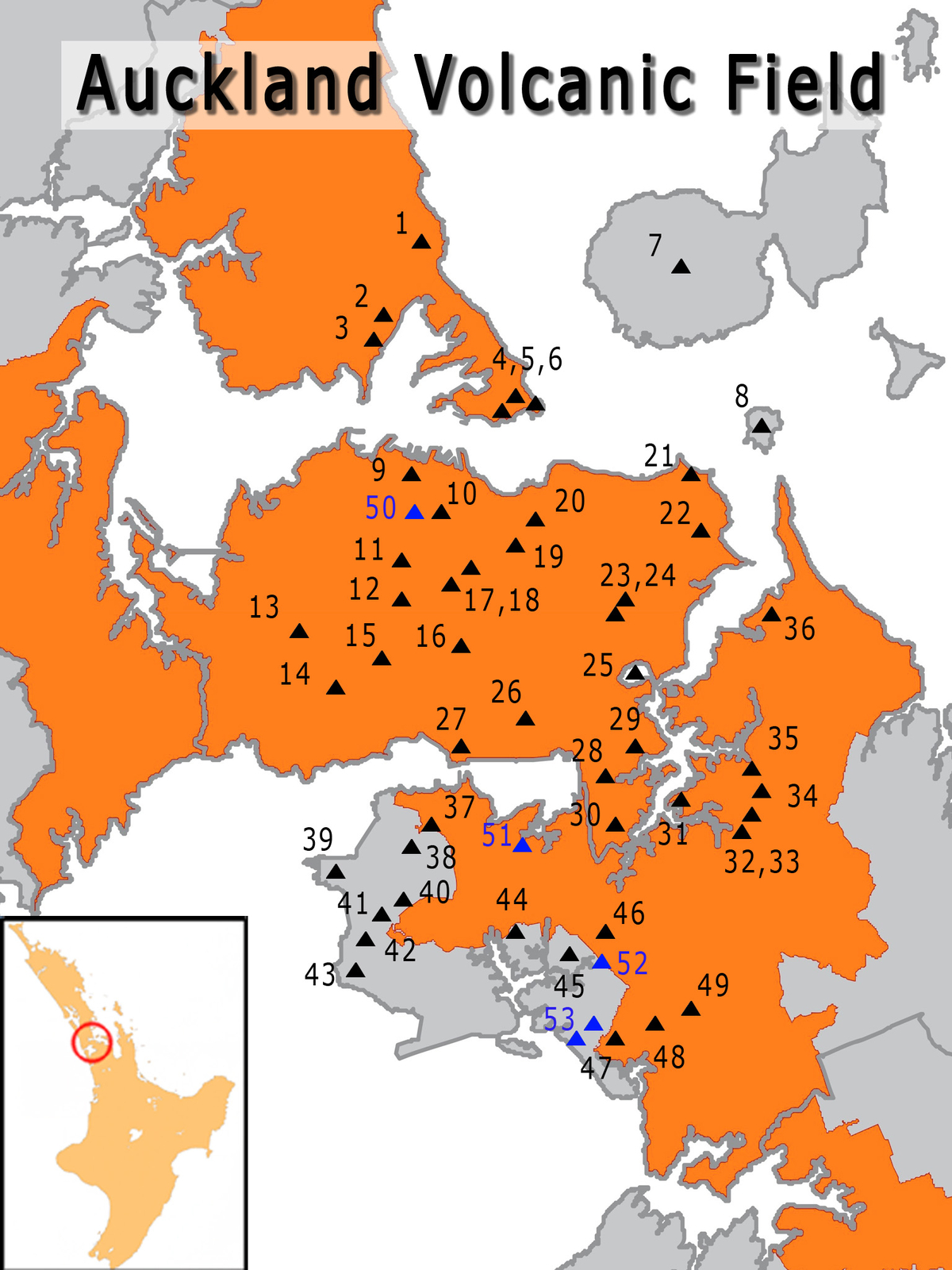
Rangitoto Island's formation near Auckland began when a series of volcanic eruptions occurred around the year 1400. These eruptions led to the creation of a unique volcanic island in the Hauraki Gulf. The Maori people witnessed the birth of this new landmass, which changed the surrounding landscape.
The eruptions that formed Rangitoto Island were significant, as they reshaped the environment and provided a home for various plant and animal species. The island's volcanic soil proved to be fertile, allowing vegetation to thrive and creating a habitat for a diverse range of flora and fauna. The Maori people eventually settled on the island and utilized its resources for their sustenance.
Over time, Rangitoto Island became a popular destination for tourists and nature lovers, drawn to its rugged beauty and unique geological features. The island's distinct cone shape, created by the volcanic eruptions, serves as a reminder of its explosive past. Visitors can explore the island's lava caves, native forests, and scenic viewpoints, experiencing firsthand the power and beauty of nature.
Today, Rangitoto Island stands as a testament to the forces that have shaped the land over centuries. Its formation by volcanic eruptions serves as a reminder of the dynamic Earth we inhabit and the ongoing processes that continue to transform our planet. By understanding the history of Rangitoto Island, we gain insight into the geological forces that have shaped New Zealand and appreciate the beauty and resilience of the natural world.
#RangitotoIsland #VolcanicEruptions #MaoriHeritage #GeologicalFormation #NaturalBeauty #NewZealandNature
Primary Reference
Volcanoes – timeline — Science Learning Hub
Explore the Life Moments of