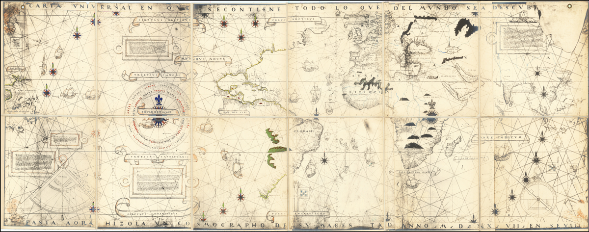
First mention of Mauritius on a map by Diogo Ribeiro in the 16th century.
Mauritius
Global Trade
2 min read
Updated By: History Editorial Network (HEN)
Published:
Diogo Ribeiro, a Portuguese cartographer, was the first to mention Mauritius on a map in 1527. The discovery stemmed from the Portuguese exploration during the Age of Discovery. This event was crucial as it marked the official recognition of the island's existence in European cartography.
The mention of Mauritius on Ribeiro's map contributed to the broader understanding of the world's geography at the time. It helped pave the way for future expeditions and colonization efforts in the region. The inclusion of Mauritius on maps also played a role in shaping the island's history and influencing its interactions with European powers in the centuries that followed.
Ribeiro's mapping of Mauritius highlighted the island's strategic location in the Indian Ocean, making it a point of interest for traders and explorers. The event ultimately influenced the island's future development and its place in global trade networks.
#MauritiusHistory #CartographyMilestone #PortugueseExploration
Primary Reference
A Hitherto Unrecognized Map by Pedro Reinel in the British Museum

Explore the Life Moments of