Google established a partnership with GeoEye to enhance its mapping services
United States
Technology
Partnerships
Space
3 min read
Updated By: History Editorial Network (HEN)
Published:
Updated:
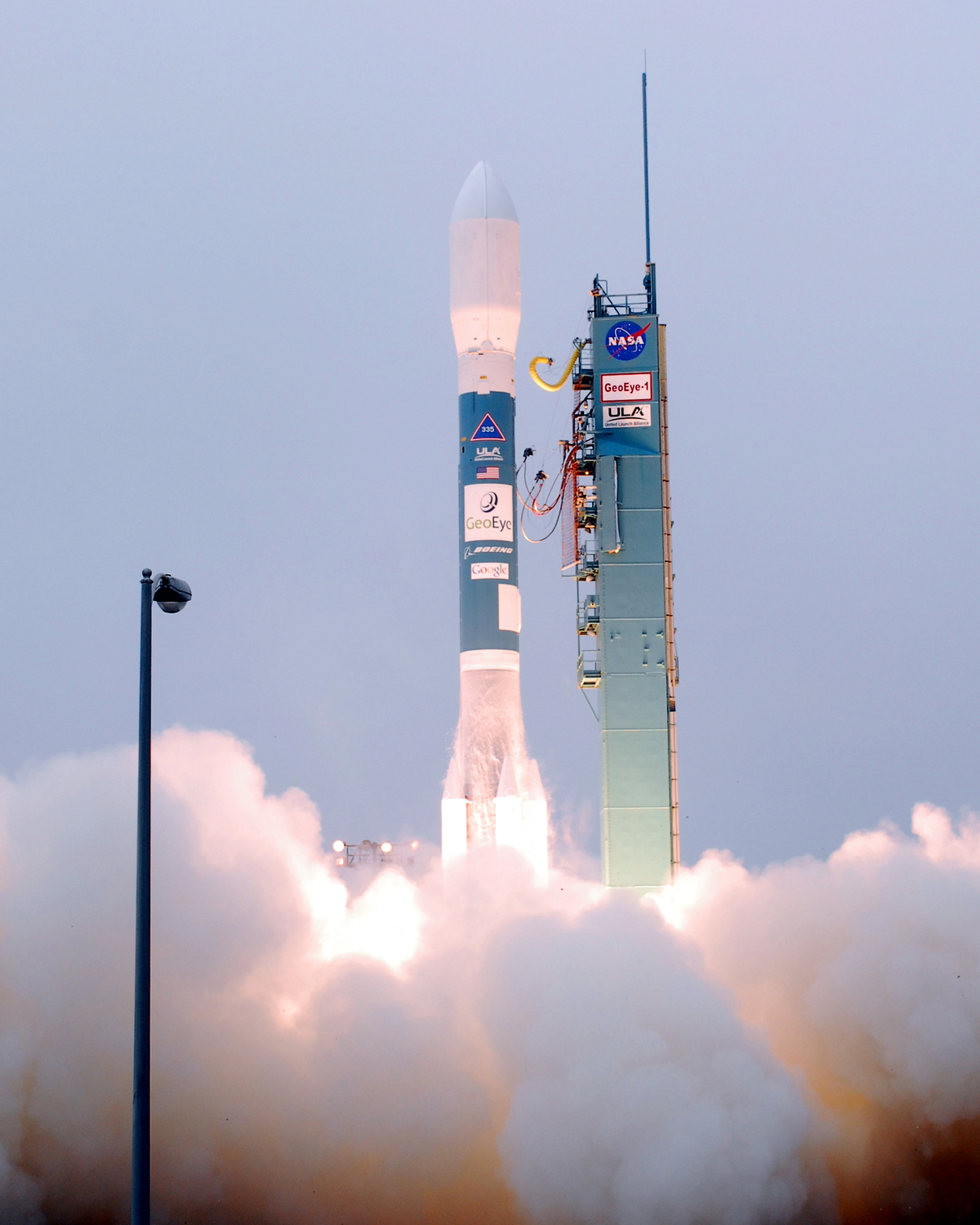
Google established a partnership with GeoEye to enhance its mapping services by launching a satellite that would provide high-resolution imagery for Google Earth. This collaboration aimed to improve the quality and detail of satellite images available to users, allowing for more accurate representations of geographical locations. The satellite was designed to capture images with a resolution of 0.41 meters for monochrome and 1.65 meters for color imagery, significantly surpassing the quality of previous satellite images used in mapping applications. The launch took place from Vandenberg Air Force Base, marking a pivotal step in integrating advanced satellite technology into Google’s services. This partnership not only expanded Google Earth’s capabilities but also set a precedent for future collaborations between technology companies and satellite imaging firms, highlighting the growing importance of high-resolution imagery in various applications, including urban planning, environmental monitoring, and disast
#mooflife
#MomentOfLife
#Google
#Geoeye
#SatellitePartnership
#High-resolutionImagery
#GoogleEarth
Primary Reference
History of Google

Explore the Life Moments of