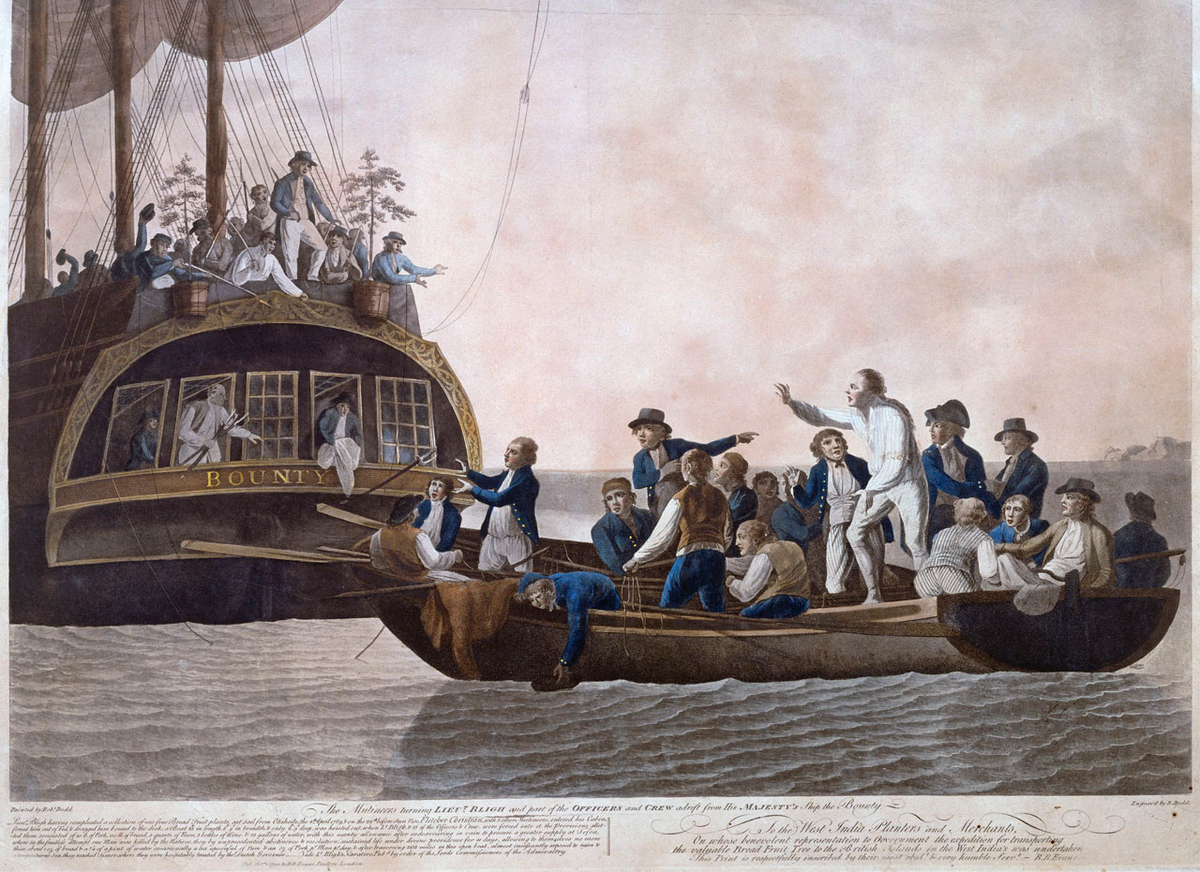
Captain Bligh's Voyage: Mapping the Fijian Islands after the HMS Bounty mutiny.
Fiji
Voyage
Maritime Navigation
3 min read
Updated By: History Editorial Network (HEN)
Published:
Updated:
Captain William Bligh, following the mutiny on HMS Bounty, undertook an extensive and gruelling journey, during which he charted and plotted parts of the Fijian islands. Bligh and the loyal members of his crew were set adrift by the mutineers in a small boat. They faced a harrowing voyage in the open sea.
During this ordeal, Bligh navigated through the Pacific and passed between Viti Levu and Vanua Levu, two of the largest islands in the Fiji archipelago. His detailed observations and recordings provided valuable information about the region, including ocean currents, wind patterns, and geographical features.
Bligh's charts contributed to the knowledge of the Pacific islands, aiding in future maritime navigation. His journey showcased remarkable survival skills and provided insights into the Fijian islands, previously less documented by Europeans. Bligh’s records would later be used to improve maps and the understanding of the Pacific region.
#CaptainBligh #FijianIslands #HMSBounty #MaritimeNavigation #OceanExploration #HistoricalVoyage #MoofLife
Primary Reference
Live, Terry/Ohio, “New” Regatta: South Pacific/NZ, Pix's

Explore the Life Moments of